On a flight from Boston to San Diego yesterday I had a window seat on the shady side. The weather was clear, and over much of the continent a dusting of snow combined with low winter sun angles to highlight subtle features of the landscape. It was like flying over a painting—maybe a Mondrian, maybe something by Chuck Close.
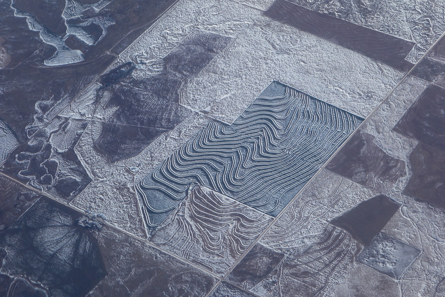
The photo above comes from central Kansas, just west of Manhattan. I don’t entirely understand what I’m seeing here. The conspicuous double wavy lines in the fields near the center of the image look like contour plowing, but the scale is all wrong; they are wider than the roads. I think they are either ditches to promote drainage or berms to prevent it. The structures are visible on Google Maps, but there they lack the chiaroscuro effect of snow and sun that gives them such drama here. What accounts for the color differences between fields?
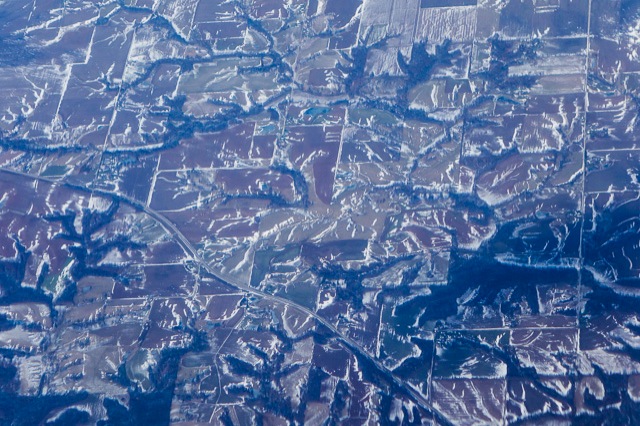
The image above is from 40 minutes earlier in the flight, over southwestern Illinois. Here the rectilinear grid of midwestern agriculture is a mere overlay on dendritic natural drainage patterns, again with bright highlighting. Apparently the snow has been swept off of flat land and gathered on slopes. The overall effect reminds me of military camouflage.
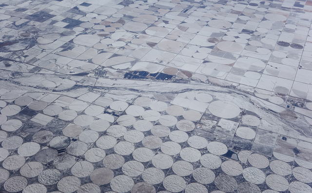
Western Kansas or southeastern Colorado: The landscape has gone all dotty with center-pivot irrigators. Always a cheering sight. If we’re going to turn the country into a checkerboard of quarter-section fields, we might as well put checkers on them. That’s probably the Cimarron River running through the middle of the frame, but I haven’t been able to identify the exact spot.
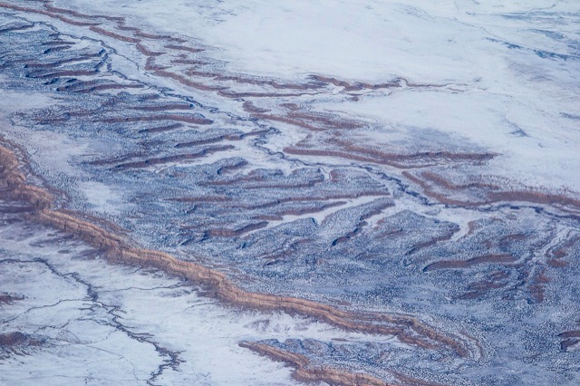
Above, more painterly drainage patterns, but this time the paintbrush is entirely in the hands of nature. I believe this is northern New Mexico, not far from Farmington.
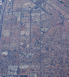
At right, we’re back on the grid again—sort of. Those tiny chiclets packed together so tighly are residential neighborhoods in Scottsdale, Arizona. They can’t escape the rectilinear pattern defined by the major streets, but inside those squares they do their best to imitate the swirly lanes and cul de sacs of a suburban housing development.
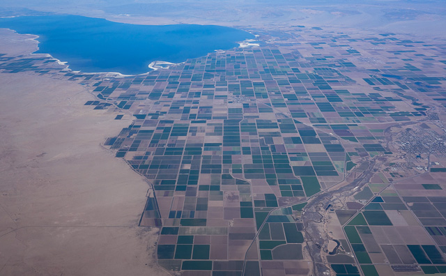
Finally, below, orthagonality reasserts itself with a vengeance in the Imperial Valley in southern California, the desert basin where most of the Colorado River winds up. At the top is the Great Oops called the Salton Sea—or what’s left of it.